
Montevideo / Research guide
Research the surroundings of an apartment in Montevideo
Combine an exact location, municipal geographic information and a viewing without inventing street-level price conclusions.
Identify the building, entrance and advertised unit before researching an apartment's surroundings in Montevideo. Then investigate the streets and journeys that matter to your routine. A neighbourhood name can orient a search without describing every home within it equally well.
Bring a specific question to the map
Search the address on the Uruguay map and inspect the block. Record the entrance street, the route you want to assess and the information that still requires a visit. Specific questions are easier to verify than a general label such as “ideal area”.
The Montevideo geographic information portal provides access to municipal mapping tools. Check the legend and the object represented by any layer you use. Territorial information can supply context without describing an individual apartment's interior conditions or expenses.
Keep observations from different sources separate. If an advertisement uses one neighbourhood label while a map follows another boundary, record that difference. Do not move the property or silently redefine the area to make the labels agree.
Use Palacio Salvo to practise changing scale
The Palacio Salvo page identifies a recognisable structure and an observed footprint of 1,809.73 m². The September 22, 2026 query had no unit area or matched parcel.
This lets you locate the building and inspect its relationship to nearby roads. It does not disclose the floor or orientation of an advertised apartment. Two units in one structure can require different questions about daylight, views, entrances or noise that an overhead outline cannot resolve.
The example is useful precisely because the building is recognisable while the unit remains unidentified. Avoid treating familiarity with the landmark as knowledge of a particular apartment.
Complete the investigation during a viewing
Check the entrance you would use and follow the route relevant to your routine. Record the time of your observation. Verify specific services and destinations instead of assuming opening hours or journey times from a map label.
Inside the apartment, observe orientation, nearby structures and conditions perceptible during the visit. Separate what you saw from what another person reported. Apply equivalent questions to alternative homes and keep unverified points visible after the viewing.
Map geometry should not be used to infer residents' characteristics or assign a social ranking to an area. Keep the research tied to observable conditions and clearly stated needs.
Do not turn context into a street price
A wider-area reference of apartment asking prices in USD does not establish the price of one Montevideo building or street. Check location precision, date, area definition and sample quality before making that connection.
Continue with comparable quality, building and padrón research or the Uruguay hub. The methodology introduces shared evidence concepts while retaining the Colombian model's stated scope.
Watch the walkthrough
Silent video with captions. Press play to load the recording.
Watch page and full transcript →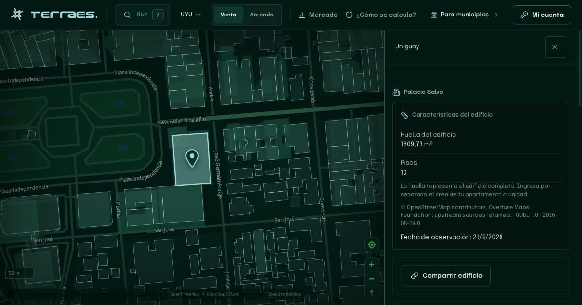
Continue your research
Review apartment comparables in Montevideo
Check duplicates, location precision, unit area and dates before treating a set of asking prices as evidence about an apartment.
Read guide →02 · UruguayFind a building and look up a padrón in Montevideo
Use an address to research a building and a municipal cadastral reference without assuming the records are already linked.
Read guide →Sources and review
By Terraes editorial team · Published · Updated
- Intendencia de Montevideo — Sistema de Información Geográfica · accessed 2026-09-22
- Overture Maps Foundation — Buildings · accessed 2026-09-22
Mapped footprints do not establish legal ownership or apartment floor area. Advertisements describe asking prices; area references are neither recorded sale prices nor official appraisals.