
Guatemala City / Research guide
Find a building by address in Guatemala City
Use the municipality and zona to locate an address, select the right building outline and understand the limits of the match.
Use an address to reach the right part of Guatemala City, then identify the building itself. A search suggestion is a location result, not confirmation of a cadastral parcel or an individual apartment. For readers unfamiliar with local addresses, retaining the zona and municipality is particularly useful when comparing search results.
Keep the original address beside the map
Open the Guatemala map and enter the street or avenue, door number if supplied, zona and municipality. Choose a suggestion only after checking those components. Keep the seller's original address in your notes. Rewriting it repeatedly until a result appears can hide an unresolved mismatch rather than resolve one.
Zoom in to inspect the surrounding block and junctions. Compare the entrance location with the listing or a reference provided by the person arranging the visit. A search pin may point to an entrance, a business or an approximate location. If it lands outside a building outline, that alone does not show that the building is missing.
Select the relevant outline and inspect its details. This additional step separates the place returned by address search from the physical structure represented in Terraes. If several outlines could fit, keep the identification provisional.
A verified example in zona 10
The building record named Holiday Inn had a footprint of 1,831.58 m² when checked on September 22, 2026. Its source was Overture release 2026-08-19.0, with OpenStreetMap attribution retained. The example illustrates building identification; it is not a residential comparable or an estimate for the hotel.
The same record had no matched parcel and no unit area. Those absences matter even though the outline is visible and named. In the verification exercise, the address search did not itself resolve the building; selecting and checking a nearby outline was necessary.
Resolve ambiguity before using the result
Check the city, municipality and zona again if the name or location looks wrong. Compare neighbouring roads, ask for the entrance location, and explain why an alternative outline is a better match before selecting it. If you cannot reconcile the information, retain the location as approximate. Do not quietly assign the nearest building to the listing.
A shared outline also does not show that two advertisements concern the same apartment. Unit number, floor and the advertised area's definition require their own evidence. A building name proves neither ownership nor the current use of every space inside.
For institutional cadastral information, consult the RIC services portal separately. Continue with land, footprint and unit area or the Guatemala hub. The methodology page provides shared terminology; its Colombian estimator should not be assumed to apply to Guatemala.
Watch the walkthrough
Silent video with captions. Press play to load the recording.
Watch page and full transcript →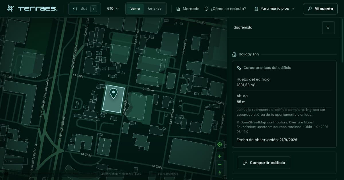
Continue your research
Where to check official geographic information in Guatemala
Choose the right source for building exploration or cadastral information, and preserve its geography, date and limitations.
Read guide →02 · GuatemalaLand, building footprint and home area in Guatemala
Identify what each area measures before comparing a plot, an entire building and an advertised home.
Read guide →Sources and review
By Terraes editorial team · Published · Updated
- Overture Maps Foundation — Buildings · accessed 2026-09-22
- Registro de Información Catastral de Guatemala — Servicios catastrales · accessed 2026-09-22
Mapped footprints do not establish legal ownership or apartment floor area. Advertisements describe asking prices; area references are neither recorded sale prices nor official appraisals.